How to Use Strait Of Hormuz Live Satellite View on Google Earth
 Import Export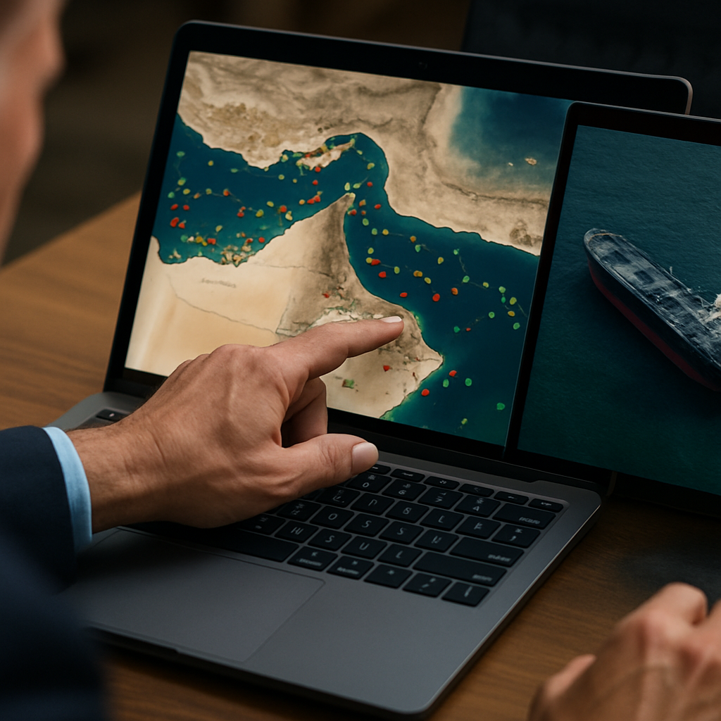
Can You Watch the Strait of Hormuz Live on Google Earth?
No, Google Earth does not stream real-time satellite video or live footage of the Strait of Hormuz. The platform displays static composite images assembled from photos taken weeks, months, or years prior to viewing.
Commercial satellite operators capture orbital photos during scheduled pass-overs, but rendering continuous high-definition video feeds for individual public users exceeds global internet bandwidth capacity. Military security protocols also restrict immediate public dissemination of raw optical footage covering sensitive geopolitical bottlenecks. Users seeking near-real-time environmental radar layers and meteorological clouds across the region can monitor updated imagery through platforms like the Zoom Earth Strait of Hormuz weather map, which refreshes satellite frames every few hours.
How to Track Vessel Movement Through Maritime Passage Routes
You can track commercial ships traveling through the waterway in real time by using coastal and satellite-based Automatic Identification System (AIS) monitoring platforms. These mapping tools broadcast vessel headings, speeds, and destinations directly to interactive marine radar dashboards.
Every commercial oil tanker and container ship transiting the Gulf must broadcast radio pulses via on-board transponders to prevent catastrophic open-water collisions. Ground stations and orbiting satellite arrays collect these signals and map active vessel locations instantaneously. Anyone watching global supply movements can use the Marine Vessel Traffic Hormuz tracker to inspect current tanker queues and bottleneck delays. While navy warships occasionally disable transponders during security incidents, commercial cargo operators maintain active broadcasts for insurance and navigation safety.
Is Shoreline Visibility Across the Narrow Waterway Possible With Human Eyes?
Yes, on clear days, observers standing along the coastal cliffs of Oman or Iran can see across the narrowest stretch of the passage with the naked eye. At its tightest pinch point, the gap shrinks to roughly 21 nautical miles, bringing northern mountain peaks directly into visual range.
Coastal haze and heavy summer humidity frequently obscure the horizon across the Gulf. However, when cool winter winds sweep away dust and fog, the Iranian shoreline stands out sharply against the water. Shipping lanes funnel giant crude carriers through narrow two-mile transit channels. This brings mega-tankers surprisingly close to shore, making vast commercial traffic visible from land without specialized optics.
Does International Maritime Law Allow Iran to Close Naval Passages?
Under the United Nations Convention on the Law of the Sea (UNCLOS), coastal states cannot legally block transit passage through recognized international straits. The law guarantees foreign vessels, including commercial cargo ships, unimpeded navigation rights through choke points connecting high seas.
Because the waterway links the Persian Gulf to open ocean waters, international treaties classify it as a transit corridor rather than internal territorial waters. Although coastal patrol vessels enforce local safety standards, attempting a physical blockade violates customary international maritime doctrine. Enforcing an embargo requires sea mines, missile threats, or naval boarding operations—actions that invite immediate military intervention to safeguard international commerce.
Where Can Internet Users Access Real-Time Free Satellite Maps?
Free, near-real-time satellite maps are accessible through open-access Earth observation networks like Sentinel Hub, NASA Worldview, and NOAA meteorological tracking portals. These public databases publish fresh planetary imagery within hours of orbital passes.
While public consumer tools like Google Earth focus on high-resolution historic imagery, scientific portals prioritize temporal frequency over optical sharpness. Users can review updated marine conditions and port traffic movements through the Cruising Earth Middle East port tracker. Environmental satellites capture raw infrared, radar, and optical data daily, serving climate researchers, maritime analysts, and logistics planners without subscription paywalls.
Where Can You Access a Live Vessel Tracking Map for the Strait of Hormuz?
The most accessible and reliable place for a real-time map of ships in the Strait of Hormuz is Strait of Hormuz Real-Time Live Ship & Marine Traffic - Cruising Earth. This site offers a dynamic, interactive map that shows the location, type, and movement direction of cargo vessels, tankers, passenger ships, military assets, and more as they cross the waterway. By selecting individual vessels, you can get specific information such as the ship's name, type, and destination.
For those wanting a quick glance, this map loads automatically and updates live, providing you a snapshot of maritime operations down to the minute. You can even filter ships by type, letting you focus on oil, cargo, or military traffic as needed. It's especially valuable for seeing patterns, potential port congestion, or response to local geopolitical events.
Other visuals and historic traffic trends are sometimes published in news outlets during high-tension events, but continuous, user-controlled updating via this interactive map is unparalleled for daily monitoring or professional use.
Can You Get a Live Satellite View of Strait of Hormuz Traffic?
While public live satellite imaging of individual vessels is rarely available due to privacy and industry regulations, you can combine tracking map overlays with satellite basemaps for a similar effect. Many professional vessel tracking platforms use embedded Google Earth or commercial satellite imagery as the map's background, enabling users to see not just ship icons but geographical and navigational features, too.
This hybrid approach lets you visually verify the ships' approximate locations relative to shorelines, oil terminals, and island chokepoints. Although the imagery itself may not be live, the vessel locations superimposed on the updated map are, offering a nearly real-time sense of both traffic density and geography.
Newsrooms sometimes provide still satellite images or annotated maps in breaking coverage, such as the analysis found in Graphic: Tracking ship traffic through the Strait of Hormuz. These graphics illustrate trends or disruption status and can complement live tracking when contextual details are needed.
For full immersion, some platforms synchronize their map views with historical traffic heatmaps, showing where ships have clustered or rerouted in the past 24 hours or after significant incidents.
What Does Strait of Hormuz Live Traffic Look Like Today?
Today's live traffic in the Strait of Hormuz can be described as moderately busy, with dozens of oil tankers, cargo ships, and support vessels moving in both directions at any given time. According to the latest updates on Strait of Hormuz Real-Time Live Ship & Marine Traffic - Cruising Earth, the waterway remains a key artery for global trade, although the number of ships varies due to economic cycles and security developments.
There are periods of sudden change. In situations of geopolitical tension or military operation announcements, traffic can thin out dramatically, as vessels reroute or anchor in safe areas. Iranian and US naval patrols add another layer of ship activity in and near the commercial shipping lanes. The real-time tracking map provides color-coded markers distinguishing cargo, tanker, military, and passenger vessels, enabling a quick assessment of the current mix on the strait.
If you observe the tracker during major news events, you'll sometimes see traffic clustering near the Gulf or pulling back altogether depending on risk levels or closure rumors.
For breaking events or extraordinary patterns, streaming visuals such as the LIVE: Vessel tracker shows traffic in Strait of Hormuz broadcast by Reuters can supplement the tracking map with live commentary and incident context.
How Do You Check the Strait of Hormuz's Status or Traffic in the Last 24 Hours?
To review the Strait's operational status and traffic patterns from the past day, use vessel tracking maps that feature historical data playback or traffic heatmap capabilities. Some specialist marine traffic services allow you to slide back in time and watch vessel positions, route density, and transit numbers unfold, making it easy to spot congestion, slowdowns, or route changes following an event.
Sites like Strait of Hormuz Real-Time Live Ship & Marine Traffic - Cruising Earth typically note abnormal conditions such as waterway closures, slowdowns, or heavy military patrols right on the interface. For analytic overviews, news analysis like that provided in Graphic: Tracking ship traffic through the Strait of Hormuz offers summary graphics depicting the magnitude of traffic fluctuations tied to world events.
If you're watching for a resumption after a closure, or assessing the impact of naval exercises or sanctions, these tools can be invaluable. Many industry professionals, policy analysts, and traders turn to these resources as a first line of insight before consulting official maritime communications.
It's always wise to corroborate public map data with official shipping bulletins or agency advisories for time-sensitive or security-critical tasks, as some traffic data may lag due to vessels' GPS privacy measures or intentional delays during crisis periods.
Is There a Strait of Hormuz Ship Tracking Map That Uses Google Earth Features?
Yes, the majority of comprehensive ship tracking sites leverage either Google Maps or Google Earth imagery as the underlying layer for their interactive vessel maps. This means you not only see live vessel markers but also get the benefit of zoomable, detailed satellite photography and geographic references. As a user, you gain the ability to spot major export terminals, assess proximity to coastlines, and understand how weather or geography might affect shipping routes.
While the Strait of Hormuz Real-Time Live Ship & Marine Traffic - Cruising Earth map integrates rich map content, you can also layer this data atop your own Google Earth interface for some commercial solutions. This ability to merge satellite terrain with dynamic maritime tracking is especially useful for maritime analysts, security consultants, and shipping professionals who need the clearest possible operational picture.
Ultimately, using a Strait of Hormuz ship tracking map that syncs with Google Earth visuals ensures you'll never have to guess about current vessel positions or their context within the local landscape. This hybrid approach delivers real-time awareness and historical insight in an intuitive, visually-rich package.